
Discover Mexico with a road trip during your 2026 World Cup stay
The 2026 World Cup provides the perfect opportunity to explore Mexico beyond the stadiums. Traveling by road through tropical jungles, colonial towns, deserts, mountains, and endless coastlines is one of the best ways to experience the country.
More than just reaching your destination, here are a few road trip itineraries to explore Mexico by stopping in small towns, sampling regional cuisine, and discovering natural reserves, hidden beaches, and spectacular viewpoints.
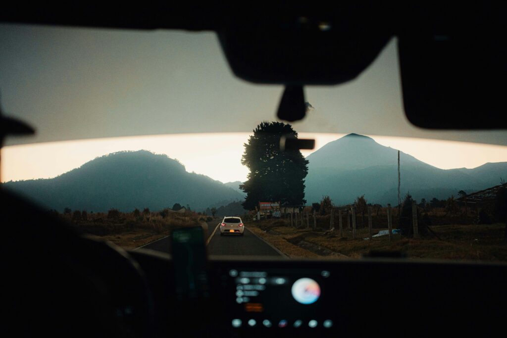
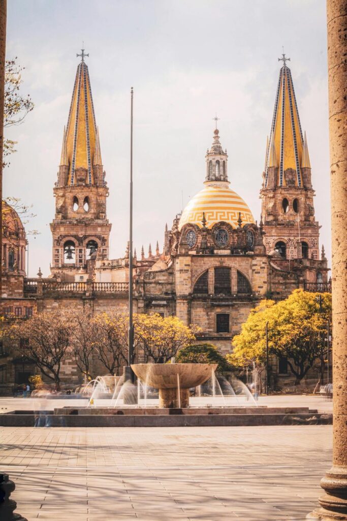
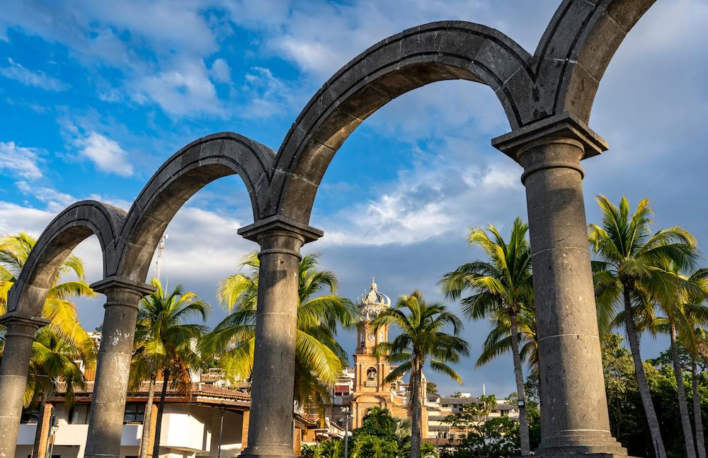
Guadalajara to Puerto Vallarta (4 hours)
While the shortcut reduces travel time between the two cities, the true beauty of this road trip lies in stopping at key towns to enjoy the diverse gastronomy and landscapes of Nayarit and Jalisco.
10:00 a.m. Take the free highway (Carretera Libre, Fed. 15) toward Tequila, Jalisco. Arriving just before noon, you can enjoy a traditional torta ahogada, stroll through the main plaza, and explore the Santiago Apóstol Parish before trying a classic cantarito drink. Before heading back to the road, walk along the tourist corridor to buy some local tequila.
12:00 p.m. Continue along the Guadalajara-Tepic highway (Federal 15D). After approximately two hours, take the exit for Federal Highway 200. As the landscape shifts into a lush jungle and you pass through the mountains, you will know you are nearing San Pancho, Nayarit. You can choose to stop in this small coastal town, known for its relaxed artistic vibe and smaller crowds, or continue to Sayulita, a livelier, surf-famous town filled with galleries, cafes, and restaurants.
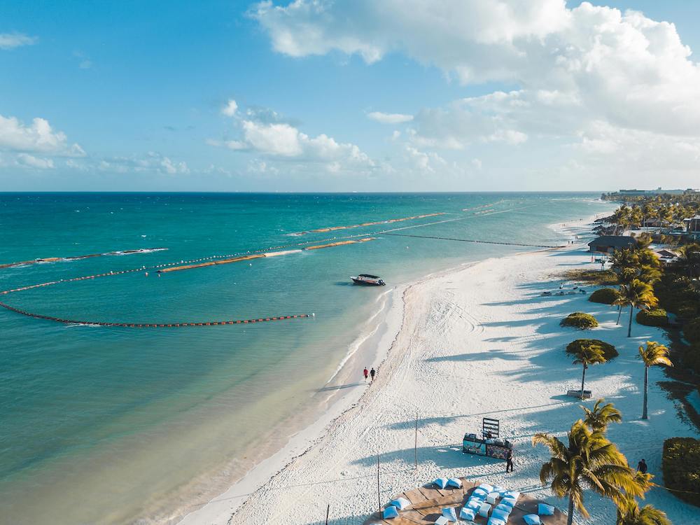
5:00 p.m. Continue heading south along the highway. The drive takes about 45 to 60 minutes through the jungle, eventually opening up to the turquoise beaches of Bucerías and passing through Nuevo Nayarit before arriving in Puerto Vallarta. Head downtown, park your car, and walk along the malecón boardwalk to catch the stunning colors of the sunset. Once here, you will find endless dining options ranging from street food to gourmet cuisine.
Mexico City to Riviera Maya (21 hours)

Given the historic and natural richness of the states it crosses—Puebla, Veracruz, Tabasco, Campeche, Yucatán, and Quintana Roo—this route offers numerous opportunities to visit Magical Towns (Pueblos Mágicos), archaeological sites, and biosphere reserves. Below is a foundational itinerary that you can customize based on your preferences and available time.
Day 1: Mexico City – Puebla – Orizaba – Córdoba
Depart at 6:00 a.m. via the Mexico-Puebla highway (MEX 150D) to watch the sunrise illuminate the Popocatépetl and Iztaccíhuatl volcanoes, enjoying the forested scenery before arriving in Puebla.
You will undoubtedly fall in love with the colonial buildings of Puebla’s Historic Center, making you want to extend your stay. Beyond the famous mole, be sure to try local specialties like pelonas, molotes, and cemitas. Finally, sweeten your morning with a churro and hot chocolate at La Catedral while watching this delicious fried dessert being prepared through the window.
Next, take highway 150D (Mexico-Veracruz) toward Córdoba, Veracruz. This road descends through mist-covered mountains, deep ravines, and rainforests. Stop in Orizaba, one of the most beautiful cities in central Mexico, which is well worth exploring. Visit the River Walk (Paseo del Río) and the Iron Palace (Palacio de Hierro), a structure designed by Gustave Eiffel. Rejoin highway 150D to arrive in Córdoba.
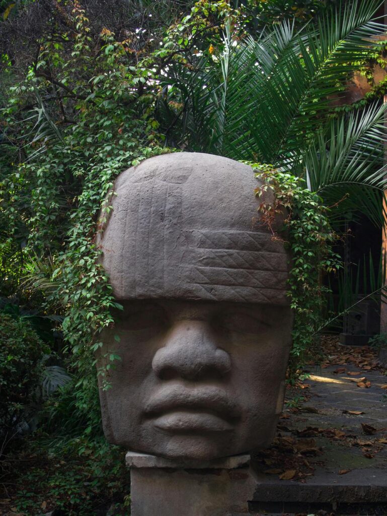
Day 2: Córdoba – La Venta – Villahermosa
Start the day with freshly made picaditas veracruzanas paired with café de olla. Take the Córdoba–Veracruz highway (MEX 150D). As you drive, the misty mountains fade into vast tropical expanses and humid jungles.
Make a stop at the La Venta Park-Museum, home to the famous Olmec Colossal Heads. Walking among massive stone sculptures surrounded by jungle vegetation reveals why the Olmec civilization is considered the “mother culture” of Mesoamerica.
After visiting La Venta, head into Villahermosa to eat and spend the night. Try the chipilín tamales and a refreshing cold or hot Tabasco chocolate made from local cacao.
Day 3: Villahermosa – Bacalar
Leave Villahermosa around 5:00 a.m. to take advantage of the cool morning hours. Take federal highway 186 and then continue along highway 307 toward Bacalar.
The route cuts through vast jungle landscapes where the vegetation becomes denser and more exuberant. You will see ceiba trees, wetlands, and long straightaways surrounded by rainforest. The entire drive takes approximately 7 to 8 hours, arriving in Bacalar around 1:00 p.m. or 2:00 p.m.
After checking into a lagoon-front hotel, take a boat tour toward the Pirates’ Channel (Canal de los Piratas), swim in the Black Cenote (Cenote Negro), or simply relax on one of the floating docks as the sun sets. At dusk, Bacalar glows in spectacular golden and pink hues. For dinner, order a tikin-xic fish cooked with achiote and citrus, or try the coconut shrimp tacos.
Day 4: Bacalar – Riviera Maya
Wake up early to watch the sunrise over the Lagoon of Seven Colors and enjoy traditional huevos motuleños, freshly baked sweet bread, or Yucatecan tamales accompanied by café de olla right by the lagoon.
Before leaving, visit the San Felipe Fort, built in the 18th century to defend the area against pirate attacks. From there, you will capture one of the best panoramic views of Bacalar and its varying shades of blue.
Around noon, take Federal Highway 307 north toward the Riviera Maya. This route travels along a portion of the Mexican Caribbean, framed by tropical jungle, small villages, and hidden cenotes tucked away in the vegetation.
At a leisurely pace with a few brief stops, you will arrive in the Riviera Maya around 5:00 p.m., just as the evening light begins to paint the Caribbean in golden and turquoise tones.
Monterrey to Los Cabos (26 hours)

This journey of over 2,000 kilometers showcases the most scenic and wild side of the country. Expect immense deserts, endless highways, northern towns, pine-covered mountains, and finally, the spectacular contrast between the turquoise sea and the desert of Baja California Sur.
Day 1: Monterrey – Saltillo
Take highway MEX 40D from Monterrey to Saltillo, a drive of about an hour and a half surrounded by semi-desert landscapes and the peaks of the Sierra Madre Oriental.
Back upon arrival in Saltillo, spend the afternoon exploring the Historic Center and visiting the Desert Museum (Museo del Desierto). For lunch or dinner, try the traditional cabrito (roasted goat) or asado de puerco (pork stew), and complement your evening with a glass of sotol.
Day 2: Saltillo – Torreón
Continue along highway MEX 40D toward Torreón. The drive takes between four and five hours, crossing vast arid plains, reddish mountains, and wide-open skies. Along the way, it is well worth stopping to breakfast on northern burritos or flour gorditas stuffed with shredded beef (carne deshebrada).
When you reach Torreón, visit the Cristo de las Noas monument to enjoy a panoramic view of the Comarca Lagunera region. If time permits, you can also explore the Bilbao Dunes (Dunas de Bilbao), a spectacular desert landscape. Don’t miss out on trying northern discada, dried beef (carne seca), and the traditional asado lagunero.
Day 3: Torreón – Durango
Take highway MEX 40 toward Durango. As you advance, the scenery gradually shifts from desert plains to forested mountainous areas.
Durango possesses a unique cinematic atmosphere thanks to its colonial architecture and natural backdrops. Stay in the historic center to explore its plazas, streets, and old buildings on foot. In the afternoon, you can visit the Cathedral, the Paseo del Viejo Oeste (Wild West theme park), or, if you have more time, the Mexiquillo natural park. For dining, try the caldillo durangueño (beef stew), gorditas laguneras, and the region’s advisor-crafted artisanal mezcal.
Day 4: Durango – Mazatlán
Depart early via the MEX 40D highway toward Mazatlán, which is one of Mexico’s most breathtaking engineering marvels. Over five to six hours, you will cross the Sierra Madre Occidental through tunnels, deep ravines, and gigantic bridges like the Baluarte Bridge (Puente Baluarte).
As you descend toward the Pacific, the climate transitions from fresh and mountainous to warm and tropical. Upon arriving in Mazatlán, stay in the Golden Zone (Zona Dorada) if you are looking for beach activities and nightlife, or in the Historic Center if you prefer a quieter, cultural ambiance. End the day walking along the malecón at sunset and dining on Sinaloan aguachile, tacos gobernador, or smoked marlin.
Day 5: Mazatlán – La Paz
Spend the morning enjoying Mazatlán before boarding the ferry to La Paz. You can enjoy breakfast by the sea with shrimp chilaquiles or a fresh ceviche. The ferry crossing between Mazatlán and La Paz takes between 12 and 16 hours, offering spectacular views of the Sea of Cortez.
Upon arriving in La Paz, the scenery shifts entirely to desert plains, giant cacti, and turquoise-water beaches surrounding the city. It is best to stay near the malecón for easy mobility to beaches and restaurants. Take the opportunity to visit Balandra Beach (Playa Balandra), Espíritu Santo Island, and stroll along the malecón at sunset. For dining, order fish tacos, chocolate clams (almejas chocolatas), and a drink made with damiana.
Day 6: La Paz – Los Cabos
Take highway MEX 1 or MEX 19 toward Los Cabos, a drive of approximately two to three hours. The road cuts through desert landscapes filled with cacti and constant views of the Sea of Cortez. Before arriving, you can stop in Todos Santos, a small town famous for its galleries, surfing, and high-end boutique hotels.
Depending on the atmosphere you seek, you can stay in San José del Cabo for a quieter, artistic experience, or in Cabo San Lucas to enjoy nightlife and water activities. To close out the journey, nothing compares to watching the sunset at Land’s End (El Arco) in Los Cabos.
Calculate tolls and fuel
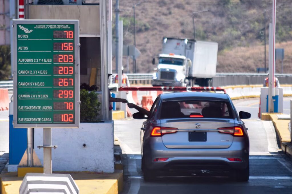
To estimate approximate costs for highway tolls, fuel, and travel times on Mexican highways, the Government of Mexico provides an official tool called “Rutas Punto a Punto” (Point-to-Point Routes) managed by the Ministry of Infrastructure, Communications, and Transportation (SCT).


